


DAYS OUT NOW COLLECTION / 10 COMPLETE WALKS
10 Peak District Walks With Parking, Toilets & Café Stops
Ten brilliant Peak District walks brought together in one useful collection. Compare distances, difficulty, parking, toilets and refreshment stops before opening the complete route guide.
PEAK DISTRICT WALKING COLLECTION
Ten brilliant Peak District walks—with the useful details sorted
Choosing a Peak District walk is easy. Working out where to park, whether there are toilets nearby and where you can stop for something to eat can take considerably longer.
This collection brings together ten of our favourite Peak District routes, from gentle woodland trails and reservoir circuits to famous ridges and challenging moorland adventures. Each one links to a complete Days Out Now guide containing the mapped route, directions, parking information and practical advice.
Facilities vary considerably across the National Park. Some routes begin beside large visitor car parks with toilets and cafés, while others have limited roadside parking and no facilities at the starting point. Always open the complete guide and check the latest local information before travelling.
At a glance
Compare the ten Peak District walks
Looking for an easy woodland wander, a famous viewpoint or a full-day challenge? Use this quick comparison to find the route that best suits your time, experience and energy levels.
| Walk | Distance | Time | Difficulty | Best for |
|---|---|---|---|---|
| Monsal Trail Adventure | 7.3 miles / 11.7 km one way | 2.5–3.5 hours | Easy | Traffic-free walking and cycling |
| Padley Gorge Walk | 3 miles / 4.8 km | 1.5–2 hours | Easy | Woodland and family adventures |
| Edale Pennine Way Loop | 3.6 miles / 5.7 km | Around 2 hours | Easy to moderate | A shorter taste of the Pennine Way |
| Burbage Rocks and Higger Tor | 6 miles / 9.7 km | 2.5–3.5 hours | Moderate | Gritstone scenery and open views |
| Mam Tor and the Great Ridge | 7.8 miles / 12.6 km | 3.5–5 hours | Moderate | Classic Peak District views |
| Kinder Scout Circular Walk | 6.2 miles / 10 km | 3–4 hours | Moderate to challenging | Wild moorland adventure |
| Dovestone Reservoir Hike | 5.9 miles / 9.5 km | 3.5–4.5 hours | Moderate | Reservoir and moorland scenery |
| Ladybower Reservoir Circular Walk | Approximately 12 miles / 19.3 km | Around 4.5 hours | Moderate | A longer reservoir adventure |
| Thor’s Cave Circular Walk | 5.7 miles / 9.2 km | 2.5–3 hours | Moderate | Caves and dramatic viewpoints |
| Lud’s Church and The Roaches | 6.8 miles / 10.9 km | Around 3.5 hours | Moderate | Legends, woodland and ridge views |
Walk collection
10 walks worth making time for.
 01
01Millers Dale, Derbyshire
Monsal Trail Adventure
Follow one of the Peak District’s easiest and most enjoyable traffic-free trails, passing old railway stations, dramatic limestone cuttings, tunnels and sweeping valley views.
The mapped route begins at Millers Dale Station, where you’ll find a large paid car park, public toilets and seasonal refreshments. The firm, mostly level trail is suitable for walkers and cyclists, although this particular route is linear, so you’ll need to arrange your return or turn back when ready.
Why choose it: Choose this route for easy walking, impressive railway history and big Peak District scenery without a difficult climb.
Information checked August 27, 2026.
02Grindleford and Longshaw, Derbyshire
Padley Gorge Walk
Step into an atmospheric woodland filled with twisted trees, mossy boulders, little waterfalls and paths running beside Burbage Brook.
Parking is available around Longshaw and Woodcroft, although spaces disappear quickly during weekends and school holidays. Longshaw offers toilets, a café and accessible facilities, making it the most convenient base for this walk. Woodland paths can be muddy, rocky and slippery after rain.
Why choose it: A beautiful choice for families, woodland lovers and anyone wanting a shorter Peak District adventure with useful facilities nearby.
Information checked August 27, 2026.
 03
03Edale, Derbyshire
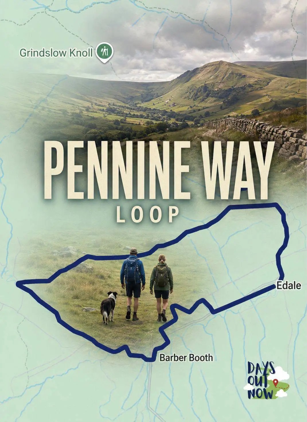
Edale Pennine Way Loop
Enjoy a shorter circular walk from Edale, following part of Britain’s famous Pennine Way through open countryside beneath the Kinder Scout plateau.
Begin at Edale’s main public car park, which has toilets and is close to the village’s cafés, pubs and railway station. The route includes fields, country lanes and uneven paths, with some muddy sections after wet weather.
Why choose it: It offers a taste of the Pennine Way without committing to a long or demanding day on Kinder Scout.
Information checked August 27, 2026.
 04
04Longshaw and Burbage Valley, Derbyshire
Burbage Rocks and Higger Tor
Cross open moorland beneath the dramatic edge of Burbage Rocks before climbing onto Higger Tor for magnificent views across the surrounding countryside.
The route can be started from the Longshaw and Woodcroft area, where parking, toilets and a café are available. Parking is extremely popular at weekends. Expect exposed moorland, uneven gritstone paths, boggy ground and very little shelter in poor weather.
Why choose it: Choose this walk for rugged scenery, fascinating gritstone formations and far-reaching views without tackling one of the Peak District’s highest summits.
Information checked August 27, 2026.
 05
05Castleton and Hope Valley, Derbyshire
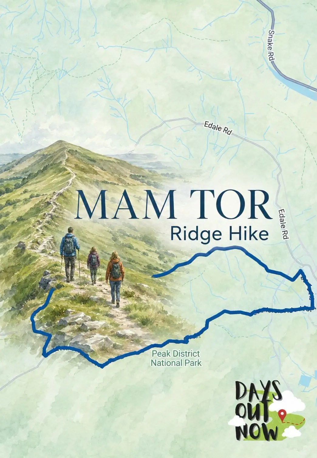
Mam Tor and the Great Ridge
Climb one of the Peak District’s most recognisable hills before following the spectacular Great Ridge high above Castleton and Hope Valley.
The complete Days Out Now route begins in Castleton, where several public car parks, toilets, cafés and pubs are available. This is a longer alternative to the short Mam Nick ascent and includes sustained climbing, exposed ridges and uneven paths.
Why choose it: This is the one to choose for a proper hill walk, unforgettable ridgeline scenery and some of the finest views in the Peak District.
Information checked August 27, 2026.
 06
06Edale, Derbyshire
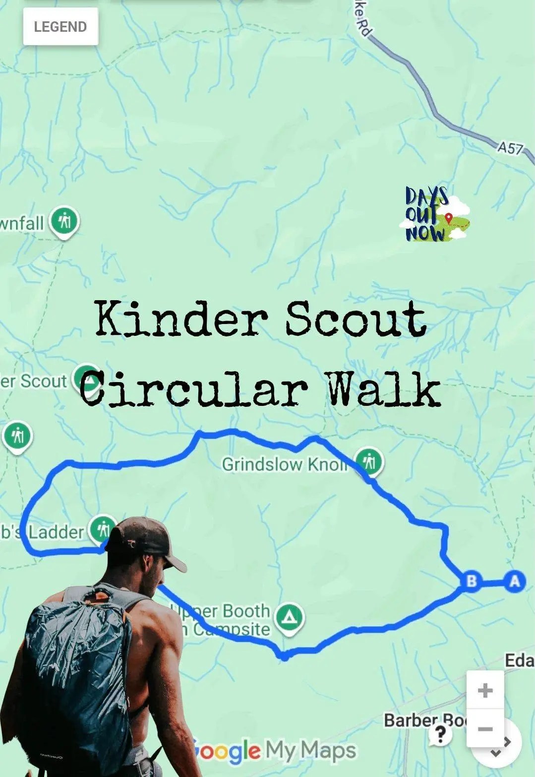
Kinder Scout Circular Walk
Climb from Edale onto the wild Kinder Scout plateau for rugged moorland, dramatic rock formations and a genuine sense of adventure.
Edale’s main public car park provides parking and toilets, with cafés, pubs and a railway station nearby. Conditions on Kinder Scout can change quickly, and the plateau may be wet, boggy and difficult to navigate when cloud descends. Take proper footwear, waterproof clothing and a reliable route map.
Why choose it: Choose Kinder Scout when you want a wilder and more challenging Peak District experience rather than a gentle countryside stroll.
Information checked August 27, 2026.
 07
07Greenfield, Greater Manchester
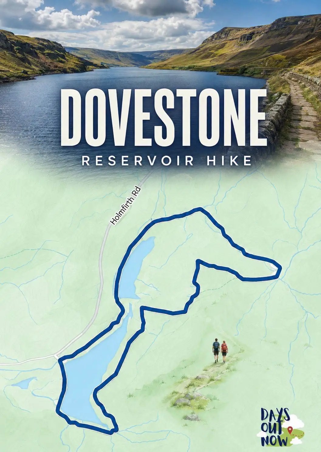
Dovestone Reservoir Hike
Explore a spectacular landscape of reservoirs, rugged hills and open moorland on the western edge of the Peak District.
The main Dovestone Reservoir car park has public toilets, although it fills quickly during fine weather and weekends. Seasonal food and drink vans sometimes visit, but there is no permanent café at the starting point, so bring refreshments. The higher paths are rough, exposed and muddy after rain.
Why choose it: This route combines waterside scenery with a more adventurous moorland climb and feels wonderfully wild despite being close to Greater Manchester.
Information checked August 27, 2026.
 08
08Bamford and the Upper Derwent Valley, Derbyshire
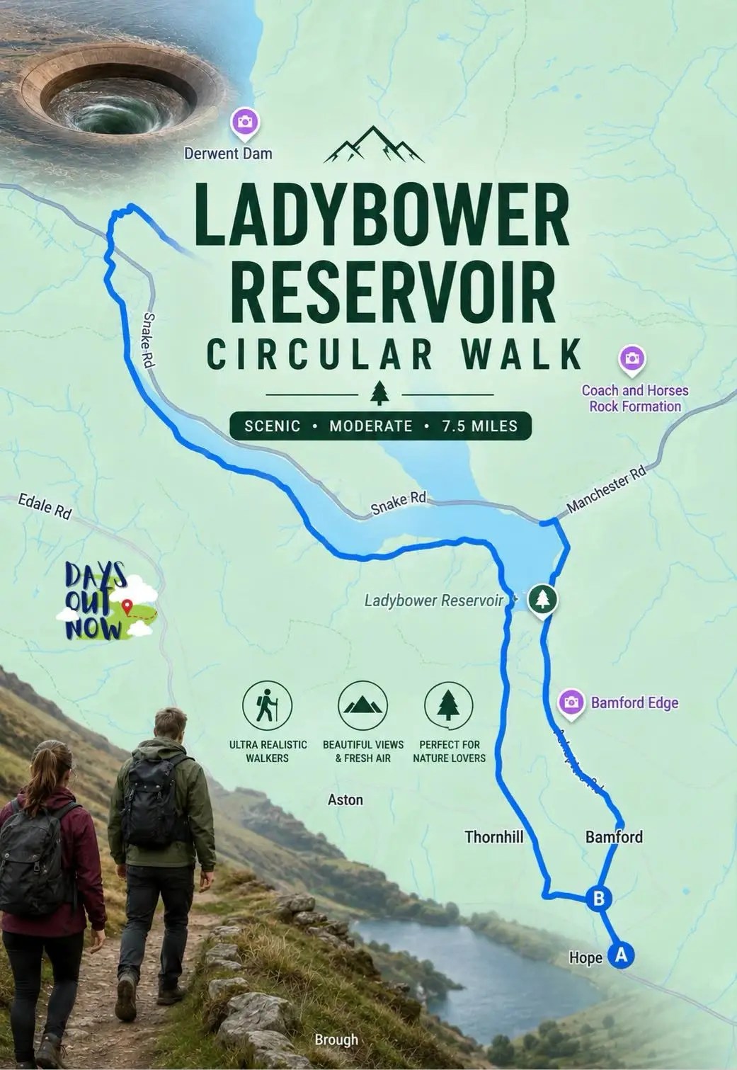
Ladybower Reservoir Circular Walk
Discover the impressive reservoirs, woodland and hills of the Upper Derwent Valley on one of the longest walks in this collection.
This is a substantial circuit rather than a short waterside wander. The mapped Days Out Now guide starts around Bamford, so use the parking and starting instructions in the full route rather than automatically travelling to Fairholmes. Facilities depend on your chosen starting point, with cafés, pubs and shops available around Bamford and nearby villages.
Why choose it: Choose Ladybower when you want a longer day out with famous reservoir scenery, woodland paths and a fascinating connection to the Dambusters story.
Information checked August 27, 2026.
 09
09Wetton and the Manifold Valley, Staffordshire
Thor’s Cave Circular Walk
Climb to one of the Peak District’s most extraordinary natural landmarks before exploring the beautiful Manifold Valley and surrounding countryside.
The route starts from Wetton, where a small public car park and toilets are available. Refreshments may be found in the village or around Wetton Mill, but opening hours can be limited. The rocky approach to the cave becomes extremely slippery when wet, and the exposed cave entrance requires particular care with children.
Why choose it: Choose this walk for its unforgettable cave entrance, limestone scenery and one of the most unusual viewpoints in the Peak District.
Information checked August 27, 2026.
10Gradbach and Upper Hulme, Staffordshire
Lud’s Church and The Roaches
Enter the mysterious moss-covered chasm of Lud’s Church before climbing onto The Roaches for sweeping views across Staffordshire and the Peak District.
Parking around Gradbach is limited and must be approached considerately, with no public toilets at the main starting area. Seasonal refreshments may be available nearby, but you should bring food and water. Expect woodland paths, steep steps, rocky ground and exposed ridges.
Why choose it: This route combines local legends, ancient-looking woodland and one of the Peak District’s finest gritstone ridges in a single adventure.
Information checked August 27, 2026.
PLAN YOUR WALK
Parking, toilets and café stops in the Peak District
Parking and facilities vary considerably across the Peak District. Popular locations including Edale, Castleton, Longshaw and Millers Dale have established public car parks, toilets and nearby refreshments, while quieter starting points may only have limited parking and no permanent facilities.
Arrive early on weekends, bank holidays and sunny days, as the most popular car parks can fill before mid-morning. Some car parks are cashless, while mobile reception can be unreliable, so download any parking apps before travelling.
Public toilets and seasonal cafés may close earlier during winter or operate reduced opening hours. Always check the complete route guide and official local information before setting off.
Peak District weather can change quickly. Take suitable footwear, waterproof clothing, food, water and an offline copy of your route. Keep dogs under close control around livestock and follow any seasonal access notices.
Collection information checked August 27, 2026.
Stay a little longer
Find somewhere that keeps the collection within reach.
Turn your walk into a proper Peak District break. Search accommodation near Castleton, Bakewell, Edale, Hathersage and the surrounding villages, giving you more time to explore without rushing home afterwards.
Accommodation links are tracked. Days Out Now may earn a commission if you book, at no extra cost to you.
Add something extra
Bookable activities near Peak District.
Discover more things to do around the Peak District, including guided walks, sightseeing tours, outdoor experiences and activities for days when you want to give your walking boots a rest.
Activity links are tracked. Prices, schedules and availability can change.
Quick answers
10 Peak District Walks With Parking, Toilets & Café Stops FAQs.
Which Peak District walk has the best facilities?
The Monsal Trail from Millers Dale is one of the easiest choices for facilities, with a large car park, public toilets and seasonal refreshments at the starting point. Longshaw, Castleton and Edale are also useful bases.
What is the easiest Peak District walk in this collection?
Padley Gorge is one of the shortest and easiest options at approximately three miles. The Monsal Trail is also mostly level and traffic-free, although the complete mapped route is linear and considerably longer.
Which is the best Peak District walk for beginners?
Padley Gorge, the Edale Pennine Way Loop and a shorter section of the Monsal Trail are good starting points. Check the complete guide before travelling, as surfaces can still be muddy, rocky or slippery.
Which walk has the best Peak District views?
Mam Tor and the Great Ridge is difficult to beat for classic Peak District views. Burbage Rocks, Higger Tor and The Roaches also provide magnificent panoramas without climbing onto the Kinder plateau.
Are Peak District car parks free?
Some smaller parking areas are free, but many official visitor car parks charge. Payment methods differ, so check the relevant guide and car park information before travelling.
Are there public toilets near these walks?
Several routes begin near public toilets, including Millers Dale, Longshaw, Edale, Castleton, Dovestone and Wetton. Facilities can have seasonal opening hours and should not be assumed to remain open throughout the evening.
Which walks have cafés nearby?
Millers Dale, Longshaw, Edale and Castleton provide some of the most convenient refreshment options. More remote routes may rely on seasonal cafés, food vans or village pubs, so carrying your own food and water is sensible.
Can I take my dog on these Peak District walks?
Dogs are welcome on many of the routes, but they must be kept under close control. Leads may be required around livestock, nesting birds and during seasonal access restrictions.
Which is the most challenging walk?
Kinder Scout is the most serious route in this collection because of its exposed plateau, rough ground and changeable weather. Ladybower is the longest, while Mam Tor includes a sustained climb and exposed ridge walking.
How can I avoid busy Peak District car parks?
Arrive early, visit during the week or choose a quieter route away from the famous viewpoints. Trains serve Edale, Grindleford, Bamford and nearby villages, making some walks possible without a car.
Keep exploring
More from Peak District.


KEEP EXPLORING
Which Peak District walk will you try first?
Whether you fancy a gentle woodland wander, a traffic-free trail or a full day among the hills, one of these routes should fit the bill. Open the complete guide, save the map and start planning your next Peak District adventure.
Useful next steps
Make a little more of the walk.
Keep the guide open for the plan. Use these live searches only for the parts you actually need.
Ad – affiliate links. If you book through these links, Days Out Now receives a commission at no extra cost to you.
Leave a Reply