

WALKING ROUTE / PEAK DISTRICT
Pennine Way Loop
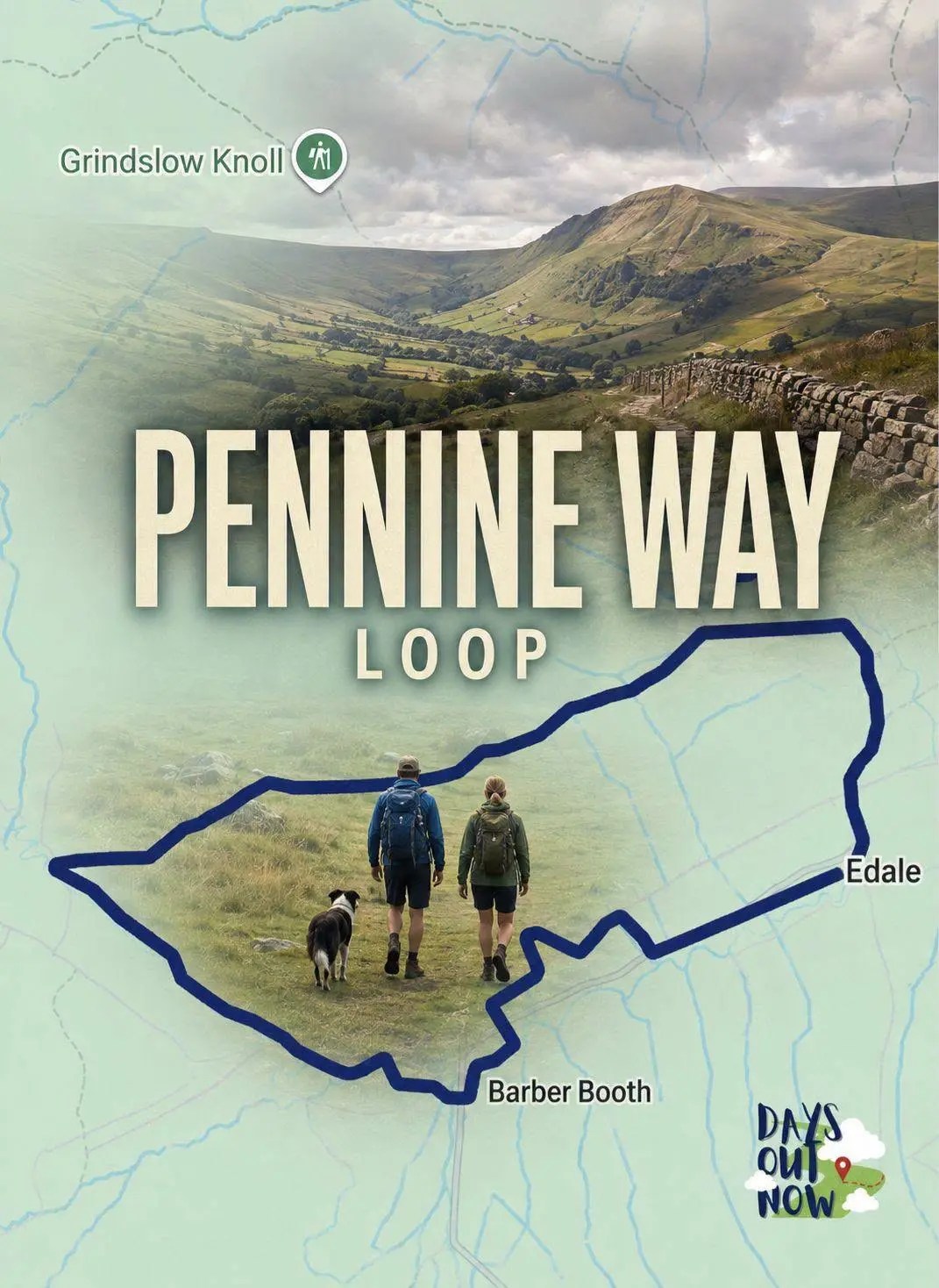
The Pennine Way loop is a gentle but rewarding loop from Edale that mixes village charm, rolling fields, moorland edges, old farm ruins, and big-sky Peak.
The route at a glance
Why this walking route is worth doing.
The Pennine Way loop is a gentle but rewarding loop from Edale that mixes village charm, rolling fields, moorland edges, old farm ruins, and big-sky Peak District scenery.
It’s the kind of walk that feels like a “proper day out” without needing to scale a mountain. Expect stone‑flagged paths, grazing fields, railway crossings, and a real sense of being tucked beneath the great ridges of Kinder.
Mapped and ready
See the route before you set off.
The genuine route overview and live map sit together, so you can understand the whole journey before opening the detailed directions.

Route overview
The Pennine Way loop is a gentle but rewarding loop from Edale that mixes village charm, rolling fields, moorland edges, old farm ruins, and big-sky Peak.
Follow the route
The Pennine Way loop is a gentle but rewarding loop from Edale that mixes village charm, rolling fields, moorland edges, old farm ruins, and big-sky Peak District scenery.
It’s the kind of walk that feels like a “proper day out” without needing to scale a mountain. Expect stone‑flagged paths, grazing fields, railway crossings, and a real sense of being tucked beneath the great ridges of Kinder.
Pennine Way Overview
A) Edale car park
B) Grindsbrook Booth
C) Old Nags Head / Start of the Pennine Way
D) Moorland edge stone‑flagged path
E) Ruined farm & turn‑off from the Pennine Way
F) Meadows, bridges & railway crossing
G) Fields back towards Edale Station and return to car park
A) Edale Car Park (Start)
Begin at the main Edale car park beside the station. Head out onto Station Approach and walk towards the village.
B) Grindsbrook Booth
Walk under the railway bridge and follow the road north, passing The Rambler Inn and heading towards the cluster of buildings at Grindsbrook Booth.
C) Old Nags Head & Start of the Pennine Way
Continue past the Moorland Centre and Edale Church until the Old Nags Head comes into view. Turn left after New Fold Farm and join the Pennine Way. Follow the stream gently uphill for around 2.6km.
D) Moorland Edge & Stone‑Flagged Path
At the top gate, turn left through another gate and continue along the stone‑flagged Pennine Way. Expect grazing cattle and wide‑open views across the valley.
E) Descent to the Ruined Farm
The path winds down between two hillocks. Pass a ruined farm building on your left, then take the rough track right to meet a lane. Before the farmhouse, leave the Pennine Way and join the public footpath on your left.
F) Meadows, Bridges & Railway Crossing
Cross two stone bridges and one wooden one, then a railway bridge. Follow the lane through farm buildings and cottages, passing Edale Methodist Chapel. At the T‑junction turn left, then join the signed path to Edale Station. Cross the railway again.
G) Fields to the Finish
After the bridge, turn right through a gate and follow the field edges through several grazing meadows. Join the concession path signed for Edale Station, cross the railway once more, and follow signs back to the car park.
Route Breakdown
Start – Grindsbrook Booth
From the car park, head into the village, passing under the railway bridge and following the quiet road towards Grindsbrook Booth. The valley opens up ahead, framed by Kinder’s steep edges.
Grindsbrook Booth – Pennine Way
Pass the Moorland Centre and Edale Church before reaching the Old Nags Head. Turn left after New Fold Farm and join the Pennine Way. The path follows a lively stream, climbing gently through a classic Peak District valley.
Pennine Way – Moorland Fields
At the top gate, turn left and follow the stone‑flagged path. This section feels wonderfully open, with grazing cattle and sweeping views. Keep dogs under close control.
Moorland Fields – Ruined Farm
The path dips between two hillocks before reaching a ruined farm building. Turn right onto the rough track, then leave the Pennine Way via the signed footpath before the farmhouse.
Footpath – Edale Station
Cross a series of bridges and a railway line, then follow the lane past cottages and the Methodist Chapel. Turn left at the T‑junction and pick up the signed path to Edale Station. Cross the railway again.
Edale Station – Car Park
Follow the field‑edge paths through several meadows, then join the concession path back towards the station. Cross the railway one final time and return to the car park.
Distance
- 5.72 km
- 3.55 miles
Places to Stay in the Peak District
What to Look Out For
- Hay meadows alive with wildflowers, butterflies, and bees in summer.
- Kinder’s dramatic skyline towering above the valley.
- Historic farm ruins offering a glimpse into old Peak District life.
- The start of the Pennine Way, one of Britain’s most iconic long‑distance trails.
- Stone‑flagged moorland paths, a Peak District trademark.
Tips
Arrive early on weekends; Edale gets busy.
The Pennine Way section can be boggy after rain despite the stone flags.
Cattle graze in several fields — give them space, especially with calves.
The route includes multiple railway crossings, all safe and well‑signed.
Waterproof boots are a good idea — streams and wet grass are common.

Want more? Check out our facebook page
Some of Our Top Posts
Live hotel map
See exactly where you could stay.
Explore live hotels and holiday accommodation around Peak District, then compare the options that fit the route rather than booking somewhere miles out of the way.
Affiliate links may earn Days Out Now a commission at no extra cost to you. Live prices and availability are set by the booking provider.
The Pennine Way loop is a gentle but rewarding loop from Edale that mixes village charm, rolling fields, moorland edges, old farm ruins, and big-sky Peak District scenery.

Pennine Way Loop: A Peak District Hike
It’s the kind of walk that feels like a “proper day out” without needing to scale a mountain. Expect stone‑flagged paths, grazing fields, railway crossings, and a real sense of being tucked beneath the great ridges of Kinder.
Pennine Way Overview
A) Edale car park
B) Grindsbrook Booth
C) Old Nags Head / Start of the Pennine Way
D) Moorland edge stone‑flagged path
E) Ruined farm & turn‑off from the Pennine Way
F) Meadows, bridges & railway crossing
G) Fields back towards Edale Station and return to car park
A) Edale Car Park (Start)
Begin at the main Edale car park beside the station. Head out onto Station Approach and walk towards the village.
B) Grindsbrook Booth
Walk under the railway bridge and follow the road north, passing The Rambler Inn and heading towards the cluster of buildings at Grindsbrook Booth.
C) Old Nags Head & Start of the Pennine Way
Continue past the Moorland Centre and Edale Church until the Old Nags Head comes into view. Turn left after New Fold Farm and join the Pennine Way. Follow the stream gently uphill for around 2.6km.
D) Moorland Edge & Stone‑Flagged Path
At the top gate, turn left through another gate and continue along the stone‑flagged Pennine Way. Expect grazing cattle and wide‑open views across the valley.
E) Descent to the Ruined Farm
The path winds down between two hillocks. Pass a ruined farm building on your left, then take the rough track right to meet a lane. Before the farmhouse, leave the Pennine Way and join the public footpath on your left.
F) Meadows, Bridges & Railway Crossing
Cross two stone bridges and one wooden one, then a railway bridge. Follow the lane through farm buildings and cottages, passing Edale Methodist Chapel. At the T‑junction turn left, then join the signed path to Edale Station. Cross the railway again.
G) Fields to the Finish
After the bridge, turn right through a gate and follow the field edges through several grazing meadows. Join the concession path signed for Edale Station, cross the railway once more, and follow signs back to the car park.
Route Breakdown
Start – Grindsbrook Booth
From the car park, head into the village, passing under the railway bridge and following the quiet road towards Grindsbrook Booth. The valley opens up ahead, framed by Kinder’s steep edges.
Grindsbrook Booth – Pennine Way
Pass the Moorland Centre and Edale Church before reaching the Old Nags Head. Turn left after New Fold Farm and join the Pennine Way. The path follows a lively stream, climbing gently through a classic Peak District valley.
Pennine Way – Moorland Fields
At the top gate, turn left and follow the stone‑flagged path. This section feels wonderfully open, with grazing cattle and sweeping views. Keep dogs under close control.
Moorland Fields – Ruined Farm
The path dips between two hillocks before reaching a ruined farm building. Turn right onto the rough track, then leave the Pennine Way via the signed footpath before the farmhouse.
Footpath – Edale Station
Cross a series of bridges and a railway line, then follow the lane past cottages and the Methodist Chapel. Turn left at the T‑junction and pick up the signed path to Edale Station. Cross the railway again.
Edale Station – Car Park
Follow the field‑edge paths through several meadows, then join the concession path back towards the station. Cross the railway one final time and return to the car park.
Distance
- 5.72 km
- 3.55 miles
Places to Stay in the Peak District
What to Look Out For
- Hay meadows alive with wildflowers, butterflies, and bees in summer.
- Kinder’s dramatic skyline towering above the valley.
- Historic farm ruins offering a glimpse into old Peak District life.
- The start of the Pennine Way, one of Britain’s most iconic long‑distance trails.
- Stone‑flagged moorland paths, a Peak District trademark.
Tips
Arrive early on weekends; Edale gets busy.
The Pennine Way section can be boggy after rain despite the stone flags.
Cattle graze in several fields — give them space, especially with calves.
The route includes multiple railway crossings, all safe and well‑signed.
Waterproof boots are a good idea — streams and wet grass are common.
Want more? Check out our facebook page
Some of Our Top Posts


Before you go
Practical information.
Build the whole day
Plan it without opening six tabs.
The route, hotel map, nearby ideas and free planning tools are all here when you need them.
See the shape of the journey
Return to the genuine route overview and interactive map before you set off.
Open the route map →Choose a base that makes sense
Compare live places to stay on the map instead of guessing from a list of names.
Explore the hotel map →Take the useful bits with you
Open the free Travel Club for route downloads, planning help and member savings.
Open the free Travel Club →Where next?
More walks in Peak District.
Keep the planning going with another mapped Days Out Now guide from the same area.


For local businesses
Own somewhere visitors should discover near Peak District?
Showcase your accommodation, food stop, attraction or activity to readers already planning a trip to the area.
Leave a Reply